Top RV Camping near Jefferson, NC
Looking for the best RV campgrounds near Jefferson? Finding a place to camp in North Carolina with your RV is easier than ever. You're sure to find the perfect campsite for your North Carolina RV camping excursion.

Looking for the best RV campgrounds near Jefferson? Finding a place to camp in North Carolina with your RV is easier than ever. You're sure to find the perfect campsite for your North Carolina RV camping excursion.


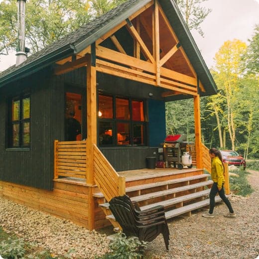
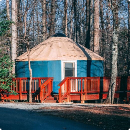
Late Cabin/Lodge/Yurt/Camping Cabin/Bunkhouse Arrivals:
A sealed packet of information with your last name will be left for you. This packet will be at one of the following places: contact station, visitor center or park office. Claytor Lake and First Landing will leave your packet at the cabin. Your last 4 digits of your confirmation number will be your access code. Please take your confirmation letter with you.
Late Camping Arrivals:
A sealed packet of information with your name will be left for you. This packet will be at one of the following places: contact station, visitor center, park office or the campground camp host site. Please take your confirmation letter with you. If you have a site specific reservation please look for your site highlighted by the yellow post along with your site number. If you have a non-site specific reservation please look for your site type to set up your equipment.
$25 - $40 / night


$23 / night


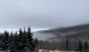
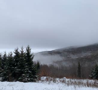
Located along the scenic Blue Ridge Parkway in the lush green expanses of North Carolina, Julian Price Campground is a top destination for boating, hiking, fishing and more. Whether it's for a family camping excursion or a peaceful getaway, this campground has something for everyone.
Canoe rentals are available at Price Lake, and other types of non-motorized boats are permitted. Fishing is also available at the lake, with a dock provided.Price Lake Trail offers a refreshing hike around the edge of the water, and the Boone Fork, Green Knob and Tanawha Trails are just a few of the trails that are conveniently accessed through the campground. Hebron Falls: A small waterfall accessed from the Boone Fork Trail. The Cascades: A beautiful waterfall accessed by the easy 1-mile loop Cascades Trail. A great hike for children. Moses Cone Flat Top Manor: A historic estate house (currently undergoing restoration) once owned by the Cone family. The grounds offer 25 miles of carriage roads to hike. Tours of the home are available. Currently houses the Southern Highland Craft Guild. Wildlife viewing is also popular as campers have a good chance of spotting bears, grouse, turkeys, owls, hawks and more.
Canoe rentals are available at Price Lake, and other types of non-motorized boats are permitted. Fishing is also available at the lake, with a dock provided.Price Lake Trail offers a refreshing hike around the edge of the water, and the Boone Fork, Green Knob and Tanawha Trails are just a few of the trails that are conveniently accessed through the campground. Hebron Falls: A small waterfall accessed from the Boone Fork Trail. The Cascades: A beautiful waterfall accessed by the easy 1-mile loop Cascades Trail. A great hike for children. Moses Cone Flat Top Manor: A historic estate house (currently undergoing restoration) once owned by the Cone family. The grounds offer 25 miles of carriage roads to hike. Tours of the home are available. Currently houses the Southern Highland Craft Guild. Wildlife viewing is also popular as campers have a good chance of spotting bears, grouse, turkeys, owls, hawks and more.
Julian Price Campground is adjacent to Price Lake, a pristine body of water that sparkles against the backdrop of rolling Carolina hills. The surrounding forest offers hemlock, white pine, oak, hickory and birch trees, along with a colorful assortment of wildflowers in the spring and an array of vivid orange and red foliage displays in autumn. The Blue Ridge Parkway is a scenic byway that follows the high crests of the central and southern Appalachians for 469 miles from Shenandoah National Park in Virginia to the Great Smoky Mountains National Park in North Carolina.
The beautiful town of Blowing Rock, located just 20 minutes away on the Blue Ridge Parkway, offers fine dining, shopping and more.
$30 / night


$20 / night


Grindstone Campground is tucked in the Fairwood Valley among pastures and wooded hillsides. The surrounding Mount Rogers National Recreation Area provides endless opportunities for fun and relaxation in the nature setting. The Campground will be closed until further notice due to facility repair needs. Opossum Loop will be open for tent campers. There will be no available water. No Dump Station available.__
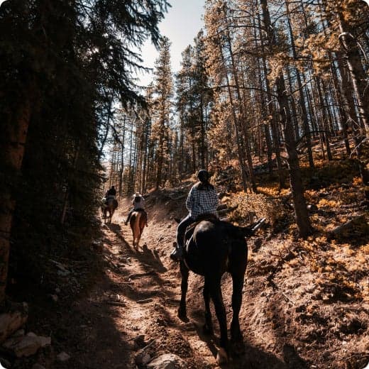
The area offers excellent hiking, mountain biking, horseback riding and hunting. Recommended hiking trails include the Mount Rogers Trail at 7.5 miles and the Whispering Waters Nature Trail at 0.6 miles. Several streams pass by just beyond the campground, with trout fishing available in abundance. The campground boasts a water play area in the creek, an amphitheater, a playground and volleyball courts to entertain families.
The area offers excellent hiking, mountain biking, horseback riding and hunting. Recommended hiking trails include the Mount Rogers Trail at 7.5 miles and the Whispering Waters Nature Trail at 0.6 miles. Several streams pass by just beyond the campground, with trout fishing available in abundance. The campground boasts a water play area in the creek, an amphitheater, a playground and volleyball courts to entertain families.
At 3,800 feet, Grindstone is surrounded by mixed hardwoods, hemlock and rhododendrons. The Mount Rogers National Recreation Area spans 200,000 acres of National Forest, with four wildlife-rich wilderness areas.
This location is unstaffed. To speak with our main office for general information, please call: (276) 783-5196.
The Mount Rogers Scenic Byway, which traverses more than 50 miles with views of forestland and open rural countryside, is accessible nearby.
$24 - $34 / night


$25 - $45 / night


Nestled in a landscape of mountains, open meadows and pioneer cabins, Doughton Park Campground is surrounded by 30 miles (48 km) of hiking trails offering opportunities to view wildlife as well as get a feel for the lives of those who lived here long ago. Originally known as The Bluffs, the area came by its present name in honor of Congressman Robert L. Doughton, a long-time advocate and supporter of the Parkway.
Over 30 miles of trails are available varying from strenuous to easy. Bicycles and motorized vehicles are prohibited on trails. Mileage listed is only traveling one way. Double the trail mileage to include out and back trip. Trail elevations can change more than 2,000 feet as trails descend into the Basin Cove Creek area from the parkway. Maps available on the Blue Ridge Parkway.gov website.__ Bluff Mountain Trail (7.5 miles) offers many scenic vistas and traverses relatively flat terrain. The trail runs near the parkway and is accessible from many locations along its route from Brinegar Cabin to Basin Cove Overlook.____ Cedar Ridge Trail (4.4 miles) descends a forested ridgeline to Grassy Gap Fire Road. Trailhead is located at the Brinegar Cabin.__ Grassy Gap Fire Road (6.1 miles) is wide enough for hikers and horseback riders to travel side by side. The trail starts at Milepost 243.9 and ambles down the mountainside past the primitive campground to State Route 1730 (Longbottom Road). Horseback riders must enter and exit at Longbottom Road.__ Flat Rock Ridge Trail (5.0) miles begins on the mountain-top meadow of Basin Cove Overlook. And ends on the damp, cool banks of Basin Cove Creek. NC Thurmond Game Lands and bear sanctuary border the south side of the trail.__ Basin Cove Creek Trail (3.2 miles) is accessible only from the grassy Gap Fire Road at the Long Bottom Road (State Hwy 1730). A 1.7-mile hike is required to reach the beginning of the Basin Cove Creek. It winds past cascading waterfalls to the century-old Caudill Cabin, former home of the Martin Caudill family. Part of the once-thriving Basin cove Community, this cabin was one of the few structures that withstood the devasting 1916 flood. Prepare for over 26 creek crossings on this trail. The total trip one way is 4.9 miles and 9.8 miles for the total trip. Bluff Ridge Primitive Trail (2.7 miles) is the shortest but steepest route into Basin Cove. The strenuous climb up the trail makes the hike seem much longer. Trailhead location is in the Bluffs Picnic Area.__ Fodder Stack Trail (1.4 miles roundtrip) shows off its delicate display of wildflowers in the spring. It is the easiest hike through a mixture of pine and hardwood forest with a short, steep brief beginning. Recommended for families. Trailhead is at Wildcat Rocks Overlook.____ The Brinegar Cabin dates from about 1885 and was the home of Martin Brinegar and his family. Brinegar was a cobbler as well as a farmer. His home is open Memorial Day weekend days through October. Hand-loom weaving and other craft demonstrations are often given during the summer months. The one-room Caudill Cabin exhibit can be viewed from the scenic Wildcat Rocks (milepost 240.6). Historic Cemetery: near milepost marker 245.5. The cemetery contains some three dozen graves dating from the 1880's to more recent times.__ The Basin Cove Creek complex (mileposts 238 - 244) (located off the Parkway on Longbottom Road) has Rainbow and Brook Trout where the streams are stocked. Anyone with a valid Virginia or North Carolina fishing license is welcome, but please check with the visitor center for any special regulations.
Over 30 miles of trails are available varying from strenuous to easy. Bicycles and motorized vehicles are prohibited on trails. Mileage listed is only traveling one way. Double the trail mileage to include out and back trip. Trail elevations can change more than 2,000 feet as trails descend into the Basin Cove Creek area from the parkway. Maps available on the Blue Ridge Parkway.gov website.__ Bluff Mountain Trail (7.5 miles) offers many scenic vistas and traverses relatively flat terrain. The trail runs near the parkway and is accessible from many locations along its route from Brinegar Cabin to Basin Cove Overlook.____ Cedar Ridge Trail (4.4 miles) descends a forested ridgeline to Grassy Gap Fire Road. Trailhead is located at the Brinegar Cabin.__ Grassy Gap Fire Road (6.1 miles) is wide enough for hikers and horseback riders to travel side by side. The trail starts at Milepost 243.9 and ambles down the mountainside past the primitive campground to State Route 1730 (Longbottom Road). Horseback riders must enter and exit at Longbottom Road.__ Flat Rock Ridge Trail (5.0) miles begins on the mountain-top meadow of Basin Cove Overlook. And ends on the damp, cool banks of Basin Cove Creek. NC Thurmond Game Lands and bear sanctuary border the south side of the trail.__ Basin Cove Creek Trail (3.2 miles) is accessible only from the grassy Gap Fire Road at the Long Bottom Road (State Hwy 1730). A 1.7-mile hike is required to reach the beginning of the Basin Cove Creek. It winds past cascading waterfalls to the century-old Caudill Cabin, former home of the Martin Caudill family. Part of the once-thriving Basin cove Community, this cabin was one of the few structures that withstood the devasting 1916 flood. Prepare for over 26 creek crossings on this trail. The total trip one way is 4.9 miles and 9.8 miles for the total trip. Bluff Ridge Primitive Trail (2.7 miles) is the shortest but steepest route into Basin Cove. The strenuous climb up the trail makes the hike seem much longer. Trailhead location is in the Bluffs Picnic Area.__ Fodder Stack Trail (1.4 miles roundtrip) shows off its delicate display of wildflowers in the spring. It is the easiest hike through a mixture of pine and hardwood forest with a short, steep brief beginning. Recommended for families. Trailhead is at Wildcat Rocks Overlook.____ The Brinegar Cabin dates from about 1885 and was the home of Martin Brinegar and his family. Brinegar was a cobbler as well as a farmer. His home is open Memorial Day weekend days through October. Hand-loom weaving and other craft demonstrations are often given during the summer months. The one-room Caudill Cabin exhibit can be viewed from the scenic Wildcat Rocks (milepost 240.6). Historic Cemetery: near milepost marker 245.5. The cemetery contains some three dozen graves dating from the 1880's to more recent times.__ The Basin Cove Creek complex (mileposts 238 - 244) (located off the Parkway on Longbottom Road) has Rainbow and Brook Trout where the streams are stocked. Anyone with a valid Virginia or North Carolina fishing license is welcome, but please check with the visitor center for any special regulations.
Rolling ridgetop meadows and steep mountainsides characterize the 7,000-acre Doughton Park. The elevation is a cool 3688 feet. It is one of the best places along the motor road to view white-tailed deer, raccoons, red and gray foxes, and bobcats. Visitors can enjoy spectacular shows of flame azalea and rhododendron in the late spring and fields of Dense Blazing Stars in mid to late July. Nearby Bluffs picnic area features open areas for night sky viewing with limited light pollution.__ The Blue Ridge Parkway is a scenic byway that follows the high crests of the central and southern Appalachians for 469 miles from Shenandoah National Park in Virginia, to the Great Smoky Mountains National Park in North Carolina.
Mount Airy, NC: Andy Griffith's hometown, the ideal American town that was the inspiration for Mayberry--Hwy 52 South; 12 miles south of Fancy Gap, VA. (www.visitmayberry.com)\_\_\_\_ Churches of the Frescoes: MP 259 - The Last Supper, Mary Great with Child, Mystery of Faith, and 7 others. Episcopal Church is always open. (www.churchofthefrescoes.com) Northwest Trading Post: Located south of Doughton Park at milepost 258 near Glendale Springs, this craft store sells handicrafts representative of the Appalachian Mountain culture. (www.CoolSparta.com)
$45 / night


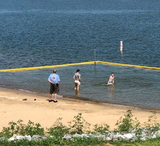
Bandits Roost Campground is located on the south side of W. Kerr Scott Reservoir in western North Carolina. Constructed in the beautiful Yadkin River Valley, the lake offers extensive opportunities for outdoor recreational activities.
The 1,475-acre reservoir offers excellent boating, canoeing, kayaking and swimming opportunities. Anglers will find channel catfish, large and smallmouth bass, bluegill, threadfin shad, spotted bass, striped bass, and hybrid striped bass. Miles of multi-use trails, that allow hiking and mountain biking, surround the lake, including the Overmountain Victory National Historic Trail, which has a trailhead at the campground. An additional 25 miles of trails can be found at the Warrior Creek and Dark Mountain areas.
The 1,475-acre reservoir offers excellent boating, canoeing, kayaking and swimming opportunities. Anglers will find channel catfish, large and smallmouth bass, bluegill, threadfin shad, spotted bass, striped bass, and hybrid striped bass. Miles of multi-use trails, that allow hiking and mountain biking, surround the lake, including the Overmountain Victory National Historic Trail, which has a trailhead at the campground. An additional 25 miles of trails can be found at the Warrior Creek and Dark Mountain areas.
The gentle Yadkin River flows through its scenic namesake valley in the foothills of the eastern Blue Ridge Mountains. Forests of mixed hardwoods, including sycamore, poplar, oak and hickory, cover the region. Wildlife is abundant in the valley. White-tailed deer, black bear, eastern cottontails and more can be found among the hills. Birds in the area include wild turkey, woodpeckers, Carolina chickadees, red-eyed vireo, ovenbirds, mallards and wood ducks.
This location has limited staffing. Please call (336) 921-3390 for general information.
$85 / night


Hurricane Campground is one of the best kept secrets in southwest Virginia. Located along a rushing mountain stream under the shade of hemlock and rhododendron, this campground offers a peaceful setting for those looking to relax as well as visitors looking for outdoor adventure. From the campsite, hikers can access many trails including the Appalachian Trail. This well-known trail extends more than 2,189 miles throughout the Appalachian Mountains across 14 states. It is a protected greenway and owns the title as the first National Scenic Trail.
Visitors frequently explore the Hurricane Knob Trail. The loop trail, at 1.1 miles, parallels Hurricane Creek for about half a mile, crosses two wooden bridges and ascends to the picturesque Hurricane Knob. The creeks are stocked with trout for a relaxing day of fishing.
Visitors frequently explore the Hurricane Knob Trail. The loop trail, at 1.1 miles, parallels Hurricane Creek for about half a mile, crosses two wooden bridges and ascends to the picturesque Hurricane Knob. The creeks are stocked with trout for a relaxing day of fishing.
The campground is perched along Hurricane Branch and Comers Creek, among colorful rhododendron. Several groomed, grassy fields unfold at the campground, but the campsites are nicely shaded by mixed woods of oak and hemlock. Hurricane Knob is nearby with an elevation from 2800 to 3050 feet.
For facility specific information, please call (276) 783-5196.
Hurricane and Comers creeks run through the campground and surrounding areas for wading and trout fishing. Additional fishing options and excellent hunting opportunities are available near the campground. State fishing and hunting regulations and licensing requirements apply. Hurricane Knob Nature Trail offers a brisk 1-mile loop hike and there is easy access to the Appalachian Trail within __ mile. The entire campground has a relaxing, rustic atmosphere and an open field allows for games and family fun.______
$20 / night
$23 / night
Located along the scenic Blue Ridge Parkway in the lush green expanses of North Carolina, Julian Price Campground is a top destination for boating, hiking, fishing and more. Whether it's for a family camping excursion or a peaceful getaway, this campground has something for everyone.
Canoe rentals are available at Price Lake, and other types of non-motorized boats are permitted. Fishing is also available at the lake, with a dock provided.Price Lake Trail offers a refreshing hike around the edge of the water, and the Boone Fork, Green Knob and Tanawha Trails are just a few of the trails that are conveniently accessed through the campground. Hebron Falls: A small waterfall accessed from the Boone Fork Trail. The Cascades: A beautiful waterfall accessed by the easy 1-mile loop Cascades Trail. A great hike for children. Moses Cone Flat Top Manor: A historic estate house (currently undergoing restoration) once owned by the Cone family. The grounds offer 25 miles of carriage roads to hike. Tours of the home are available. Currently houses the Southern Highland Craft Guild. Wildlife viewing is also popular as campers have a good chance of spotting bears, grouse, turkeys, owls, hawks and more.
Canoe rentals are available at Price Lake, and other types of non-motorized boats are permitted. Fishing is also available at the lake, with a dock provided.Price Lake Trail offers a refreshing hike around the edge of the water, and the Boone Fork, Green Knob and Tanawha Trails are just a few of the trails that are conveniently accessed through the campground. Hebron Falls: A small waterfall accessed from the Boone Fork Trail. The Cascades: A beautiful waterfall accessed by the easy 1-mile loop Cascades Trail. A great hike for children. Moses Cone Flat Top Manor: A historic estate house (currently undergoing restoration) once owned by the Cone family. The grounds offer 25 miles of carriage roads to hike. Tours of the home are available. Currently houses the Southern Highland Craft Guild. Wildlife viewing is also popular as campers have a good chance of spotting bears, grouse, turkeys, owls, hawks and more.
Julian Price Campground is adjacent to Price Lake, a pristine body of water that sparkles against the backdrop of rolling Carolina hills. The surrounding forest offers hemlock, white pine, oak, hickory and birch trees, along with a colorful assortment of wildflowers in the spring and an array of vivid orange and red foliage displays in autumn. The Blue Ridge Parkway is a scenic byway that follows the high crests of the central and southern Appalachians for 469 miles from Shenandoah National Park in Virginia to the Great Smoky Mountains National Park in North Carolina.
The beautiful town of Blowing Rock, located just 20 minutes away on the Blue Ridge Parkway, offers fine dining, shopping and more.
$30 / night
$20 / night
Grindstone Campground is tucked in the Fairwood Valley among pastures and wooded hillsides. The surrounding Mount Rogers National Recreation Area provides endless opportunities for fun and relaxation in the nature setting. The Campground will be closed until further notice due to facility repair needs. Opossum Loop will be open for tent campers. There will be no available water. No Dump Station available.__
The area offers excellent hiking, mountain biking, horseback riding and hunting. Recommended hiking trails include the Mount Rogers Trail at 7.5 miles and the Whispering Waters Nature Trail at 0.6 miles. Several streams pass by just beyond the campground, with trout fishing available in abundance. The campground boasts a water play area in the creek, an amphitheater, a playground and volleyball courts to entertain families.
The area offers excellent hiking, mountain biking, horseback riding and hunting. Recommended hiking trails include the Mount Rogers Trail at 7.5 miles and the Whispering Waters Nature Trail at 0.6 miles. Several streams pass by just beyond the campground, with trout fishing available in abundance. The campground boasts a water play area in the creek, an amphitheater, a playground and volleyball courts to entertain families.
At 3,800 feet, Grindstone is surrounded by mixed hardwoods, hemlock and rhododendrons. The Mount Rogers National Recreation Area spans 200,000 acres of National Forest, with four wildlife-rich wilderness areas.
This location is unstaffed. To speak with our main office for general information, please call: (276) 783-5196.
The Mount Rogers Scenic Byway, which traverses more than 50 miles with views of forestland and open rural countryside, is accessible nearby.
$24 - $34 / night
$25 - $45 / night