
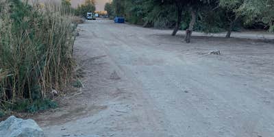
Anglers and wildlife watchers flock to this dispersed camping area along a small lake managed by the Bureau of Land Management. Located down a 3.5-mile gravel road that requires careful navigation, Fortuna Pond sits in agricultural country where irrigation channels and farm roads create an unconventional approach to camping.
The sandy shoreline provides multiple camping spots with direct water access. Campers set up along the lake's perimeter, with many choosing sites that offer both water views and proximity to the single port-a-potty. The sand stays warm well into the evening hours, which some tent campers find uncomfortably hot during summer visits. John R. noted the sand "never cooled down at night" and turned his tent into a "solo-sweat lodge."
Fishing draws many visitors to the lake's shores, where ducks and other waterfowl are commonly spotted. The water also attracts mosquitoes, particularly during warmer months, so insect repellent becomes essential. A nearby private airstrip occasionally generates aircraft noise, and Beth M. warns that "getting here is not for the faint of heart" due to the irrigation road access.
The campground provides basic amenities including trash collection, a chemical toilet, and allows campfires, though no fire rings are present. Cell service reaches the area, and pets are welcome. The site can become crowded, especially during cooler months when desert camping peaks. Several nearby options include Fortuna Lake and Yuma VFW.
This free camping spot works best for self-sufficient campers comfortable with rustic conditions and challenging road access, particularly those prioritizing water access and fishing opportunities.
Description
CLOSED
Location
Dispersed CampingFortuna Pond - CLOSED is located in Arizona
Directions
LOCATION From I-8, turn north on Araby Road and travel 1.5 miles to Highway 95. Turn east on Higway 95 and travel 1/2 mile to Ave. 7 E. Turn north on Ave. 7 E and travel 1.5 miles to the levee. The levee is on the north side of the Main Outlet Drain. Turn east on the levee road and travel approximately 3.4 miles, Fortuna pond will be on your left.
Coordinates
32.72373114 N
114.455483 W
Connectivity
 T-Mobile5GExcellent CoverageVerified by 6 usersLast on 1/14/26
- Verizon5GExcellent CoverageVerified by 2 usersLast on 12/11/25
 AT&TLTESome CoverageVerified by 2 usersLast on 4/1/26
Connectivity
- T-Mobile5GExcellent CoverageVerified by 6 usersLast on 1/14/26
- Verizon5GExcellent CoverageVerified by 2 usersLast on 12/11/25
- AT&TLTESome CoverageVerified by 2 usersLast on 4/1/26
Access
- Drive-InPark next to your site
Site Types
- Dispersed
Features
For Campers
- Trash
- Picnic Table
- Phone Service
- Toilets
- Alcohol
- Pets
- Fires
For Vehicles
- Sanitary Dump
- Pull-Through Sites
DISPERSED CAMPING
Enjoy dispersed camping on government land and leave no trace. Pack in and pack out. No (or limited) services at this camping area. Permit may be required.
PERMIT might be REQUIRED
We curate permit requirements across the US for our PRO members. Try PRO to see if Fortuna Pond - CLOSED needs a permit.
Drive Time
- 15 min from Yuma, AZ
- 1 hr 1 min from El Centro, CA
- 2 hrs 19 min from San Diego, CA
- 2 hrs 22 min from Lake Havasu City, AZ


