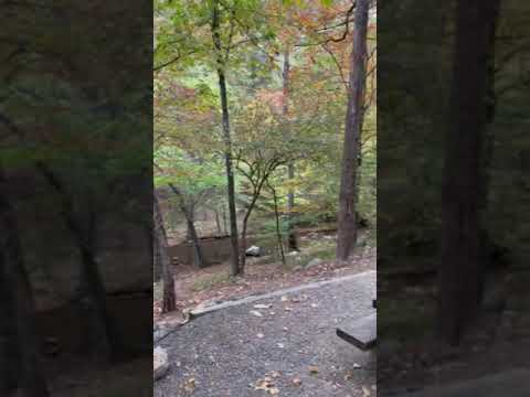
Ouachita National Forest encompasses Shady Lake Campground, a Forest Service facility that operates from mid-March through mid-November near Umpire, Arkansas. The campground spans four loops with sites accommodating RVs up to 32 feet, plus walk-in tent areas for those seeking more distance from neighbors. A creek runs alongside many sites, and campers consistently mention the sound of flowing water throughout the night.
Loop C draws particular attention from repeat visitors, as it sits closest to the creek with more primitive options. Tracey L. notes "some will think they are awful, but to others they are a bonus" when describing these more rustic sites. The campground operates on a first-come, first-served basis for most sites, though reservations are available for some areas. Recent construction has modified Loop A to accommodate larger rigs, changing the character of that section.
The lake allows non-motorized watercraft and swimming, though several reviewers mention the bottom is covered with leaves. A dock extends into the water for swimming and jumping. Multiple hiking trails connect from the campground to longer forest routes, and the area provides access for ATV riding and hunting outside the recreation area boundaries. Cell service is minimal to nonexistent, requiring a short drive down the road for signal.
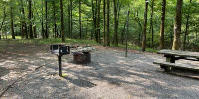
Bathhouses with flush toilets and showers serve each loop, though reviewers note typical forest conditions with insects present. Sites with water and electric hookups cost more than primitive options, with additional water spigots available for dry campers. The campground tends to fill during weekends and holidays, while weekdays remain quieter. For those seeking alternatives, Eagle Rock Vista provides another option to the east.
Description
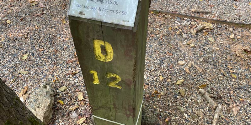
Scenic 25-acre lake in remote mountain setting.The Civilian Conservation Corps developed the Shady Lake Recreation Area in 1937. The Shady Lake Trail traverses Saline Creek and passes the historic Shady Lake Dam. It continues along the eastern edge of the campground. The trail is ideal for day hiking. Mountain bikers may also use the trail. Individual campsite temporary closings: For your safety, the following campsites are closed while being evaluated for risk of flooding: B12, B14, B18, B20, B21, C1, C2, C3, C4, D4, D6, D8, D10
RV Road Trip Guides


Location
Public CampgroundShady Lake Campground is located in Arkansas
Directions
Take Arkansas Hwy. 84 west of Glenwood, AR; turn northwest on Arkansas Hwy. 246 at Athens, AR; turn right (north) at sign, drive 3 miles on Forest Service Road 38.
Coordinates
34.36435600000005 N
94.0292503 W
Connectivity
 T-MobileNo Coverage
 VerizonLTESome CoverageVerified by 1 userLast on 4/3/26
- AT&TNo Coverage
Connectivity
- T-MobileNo Coverage
- VerizonLTESome CoverageVerified by 1 userLast on 4/3/26
- AT&TNo Coverage
Access
- Drive-InPark next to your site
- Walk-InPark in a lot, walk to your site.
Site Types
- Tent Sites
- RV Sites
- Standard (Tent/RV)
- Group
Features
For Campers
- ADA Access
- Trash
- Picnic Table
- Firewood Available
- Phone Service
- Reservable
- Showers
- Drinking Water
- Electric Hookups
- Toilets
- Alcohol
- Pets
- Fires
For Vehicles
- Sanitary Dump
- Sewer Hookups
- Water Hookups
- Pull-Through Sites
- 30 Amp Hookups
Drive Time
- 1 hr 11 min from Hot Springs, AR
- 1 hr 31 min from Texarkana, TX
- 1 hr 55 min from Little Rock, AR
- 2 hrs 13 min from Fort Smith, AR