Arkansas State Parks manages Mount Nebo State Park, where this mountaintop campground sits at 1,800 feet elevation after a challenging drive up steep switchbacks with grades reaching 18%. The access road restricts RVs to 24 feet maximum, keeping larger rigs away and creating a more intimate camping atmosphere.
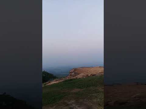
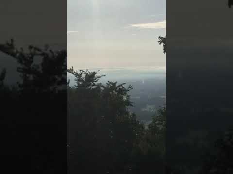
Sites spread across the mountain summit, with several positioned directly on the rim offering expansive valley views below. Dave V. notes that sites 14, 16, and 17 sit "directly on the Rim with unimpeded long views and unobstructed breezes." The elevation brings constant air movement, though some campers find the wind strong at times. Private residences intersperse among the camping areas and cabins, creating an unusual mixed-use layout that can initially confuse first-time visitors.
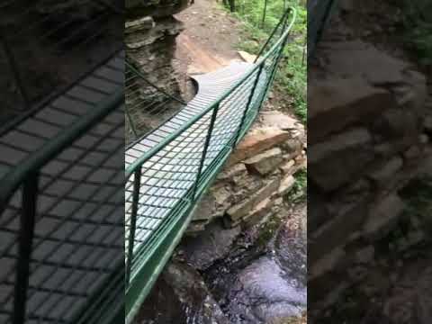
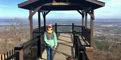
The 3.5-mile Rim Trail circles the mountaintop with sections ranging from easy to strenuous, connecting Sunset Point and Sunrise Circle viewpoints accessible by vehicle. Hike-in campsites are available along this trail system for those seeking more isolation. A swimming pool operates seasonally with additional fees, while the stone visitor center provides valley overlooks from its back porch. The campground includes standard hookups with electric, water, sewer connections, and dump station access.
Check-in requires driving past the camping area to reach the visitor center deeper in the park. Valerie warns the "outlay of the park is somewhat confusing" and recommends studying a map beforehand. Many sites require leveling blocks due to uneven terrain. The location is a dry county, so campers wanting alcohol must purchase it before ascending the mountain.
For those preferring lake access over mountain views, Dardanelle Campground — Lake Dardanelle State Park provides a flatter alternative with water recreation opportunities.
RV Road Trip Guides


Location
Public CampgroundMount Nebo State Park Campground is located in Arkansas
Directions
The park is seven miles west of Dardanelle on Ark. 155. [NOTE: Ark. 155 zigzags and includes hairpin curves. Trailers over 24 ft. should not attempt the climb up Mount Nebo.]
Coordinates
35.21900062 N
93.247 W
Connectivity
 T-Mobile5GExcellent CoverageVerified by 2 usersLast on 4/3/26
 VerizonLTESome CoverageVerified by 1 userLast on 4/3/26
- AT&T5GExcellent CoverageVerified by 2 usersLast on 4/3/26
Connectivity
- T-Mobile5GExcellent CoverageVerified by 2 usersLast on 4/3/26
- VerizonLTESome CoverageVerified by 1 userLast on 4/3/26
- AT&T5GExcellent CoverageVerified by 2 usersLast on 4/3/26
Access
- Hike-InBackcountry sites.
- Boat-InSites accessible by watercraft.
Site Types
- Dispersed
- Tent Cabin
- Yurts
- Equestrian
Features
For Campers
- WiFi
- Alcohol
For Vehicles
- Sanitary Dump
- Sewer Hookups
- Pull-Through Sites
- 30 Amp Hookups
Drive Time
- 1 hr 18 min from Little Rock, AR
- 1 hr 25 min from Fort Smith, AR
- 1 hr 35 min from Hot Springs, AR
- 1 hr 52 min from Fayetteville, AR