Legend
Tucked away between mountains - cools off nicely at night
This Forest Service campground is just outside of Aspen in the White River National Forest. We hadn't planned to come as far south as Aspen, but fires kept us from getting to another campground and a dispersed camping area. Sites are reservable, but we were able to get a site on a rainy Sunday evening for two nights. The campground filled up both nights (although there were no shows for reserved sites both nights.
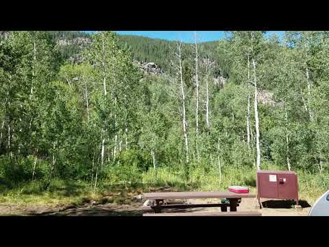
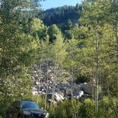
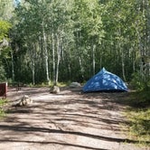
This campground is tucked away east of Aspen in a beautiful forest of aspens between mountains covered with pines. For the most part, the sites are carved out with plenty of space and cover between you and your neighbors. Everything is lush and green, but no campfires and no outdoor smoking are allowed (July 2018) because of fire danger.
Our site (#9) must have had a 20 foot buffer between us and our neighbors. (See 360 degree video.)
Cool sites in addition to #9:
12 and 13 - there is a steep boulder field behind these sites which looks like a fun climb
18 and 40 - pitch your tent way back, or the driveway is good for a camper and tow vehicle
43 - nice view, deep site
Activities:
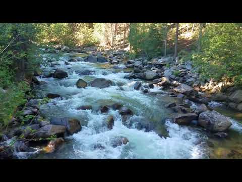
Difficult River runs along one side of the campground, and the Difficult Trail begins near the entrance. The trail starts at about 8,000 feet and is not maintained after 3 miles (according to the camp host) but continues on for 3 miles up to an elevation of more than 10,000 feet.
Bike the paved/packed stone bike path known as the East of Aspen Trail Extension into Aspen. It's an easy ride and goes through a wetlands area with viewing stops. There's supposed to be a moose in the area, but I only saw a fairly large fox early one morning. The host had warned us that the fox would go after anything you leave out.
In Aspen, you can connect with the Rio Grande Trail, a 42 mile paved trail (with a small portion of gravel somewhere that I didn't see). This trail connects Aspen to Glenwood Springs and goes through the towns of Basalt and Carbondale. It follows an old railroad bed, so it doesn't have steep climbs although the trail brochure mentions some short, steep climbs into Aspen from the north. We didn't bike that part. The trail between Carbondale and Arciero/Old Snowmass Trailhead has great scenery - Roaring Fork River, Cottonwood Pass, Basalt Mountains, ranches. There are several points where you can catch a bus if you want to do a one way ride. Here is the URL for an excellent brochure: https://www.rfta.com/wp-content/uploads/2015/11/trailmap.pdf