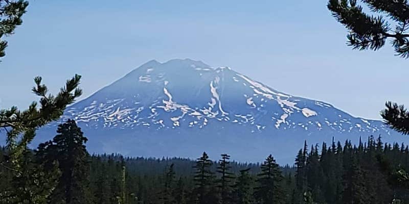
Swimming and paddling opportunities draw campers to Forlorn Lakes, a Forest Service campground where multiple alpine lakes provide direct water access from individual sites. The campground operates from mid-July through mid-October at elevations that can bring cooler temperatures even in summer.
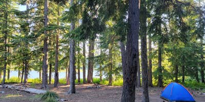
Twenty-one sites spread across different lake levels, with sites 16-21 positioned on the largest lake offering the most extensive water access. Site 17 consistently receives praise from returning visitors, while lower-numbered sites like 7 provide access to smaller, more intimate lakes suitable for swimming and non-motorized watercraft. RVs are limited to 18 feet and restricted to certain areas due to terrain constraints. Vault toilets serve the campground, and wild huckleberries grow throughout the forest during late summer.
Access requires navigating approximately 15 minutes of gravel road with rocks and deep ruts that demand slow, careful driving. "The road turns to gravel about 15 minutes before you reach the site and its pretty bumpy in some spots," notes Allison W.. The upper lake receives recommendations for fishing attempts, though success varies. Trout Lake provides the nearest services for supplies. Arriving Sunday afternoon or Monday increases chances of securing a lakeside site during peak season.
Description
Forlorn Lakes, one of the most popular campgrounds in the southern part of the forest, offers 25 campsites scattered around the wooded shores of small, picturesque lakes. Swimming and fishing are possible in the larger lakes. Huckleberry bushes grow in the campground and surrounding area making this site very popular during huckleberry season. The campsites at a maximum 18 feet long are suitable for tent camping and small campers or RV's. The day use area has lake views, picnic tables, and fire rings. The campground is very popular, the camping spots fill early in the week. Forlorn Lakes offers nearby access to Indian Heaven via the East Crater Trailhead.
RV Road Trip Guides

Location
Public CampgroundForlorn Lakes is located in Washington
Directions
In Trout Lake, WA, at intersection of State Rt. 141 and Mt. Adams Rec Hwy, take Rt. 141 north 7.9 miles to Goose Lake/Forest Rt. 60 signs. Continue straight onto Rt. 60 and go 1.5 miles to "T" intersection. Turn right, staying on Rt. 60 (gravel) and go 0.1 miles to a "Y" intersection. Bear right, continuing on Rt. 60, and go 1.7 miles to an intersection and Forlorn Lakes sign. Turn left at sign onto Forest Rt. 6030 and go 2 miles to campground sign. Turn left at sign onto Forest Rt. 6040 into the campground or continue straight for another 0.2 miles to sites 22 through 25. NOTE: Forest Rt. 6030 becomes Forest Rt 6035 and is a dirt, rough, narrow roadway for last 1.8 miles.
Coordinates
45.9590002 N
121.75700097 W
Connectivity
 T-MobileNo Coverage
- VerizonNo Coverage
 AT&TLTESome Coverage
Connectivity
- T-MobileNo Coverage
- VerizonNo Coverage
- AT&TLTESome Coverage
Access
- Drive-InPark next to your site
- Walk-InPark in a lot, walk to your site.
- Hike-InBackcountry sites.
Site Types
- Tent Sites
- Standard (Tent/RV)
- Group
Features
For Campers
- Trash
- Picnic Table
- Toilets
- Alcohol
- Pets
- Fires
Drive Time
- 2 hrs 4 min from Portland, OR
- 2 hrs 43 min from Longview, WA
- 3 hrs 8 min from Yakima, WA
- 3 hrs 33 min from Olympia, WA


