

Within Mount Rainier National Park, Glacier Basin Backcountry Campsites provides National Park Service-managed camping in open terrain near the White River. This backcountry location requires rough access but rewards hikers with five individual sites plus one group site positioned for mountain views.
Site #2 sits directly across from the group area, offering no privacy but clear sightlines toward Mount Rainier. The flat sites accommodate multiple tents with room for camp chairs. Two bear canisters handle food storage requirements, while a composting toilet sits a short hike away from the main camping area. The nearby White River serves as a water source for filtering. Wildlife reports include deer, squirrels, and occasional bear activity, though frogs appear more commonly around the water. Campers exploring campgrounds around Mount Rainier National Park will find this site works best for backpackers comfortable with minimal facilities and open camping conditions.
Description
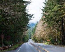
Once the site of an old mining camp near the Inter Fork River, Glacier Basin sits at 5,970 feet in elevation, in a deep, glacial valley below 8,690-foot Mount Ruth and 7,830-foot Burroughs Mountain. Above the basin, the small Inter Glacier is flanked by the much larger Winthrop and Emmons glaciers—the latter being the largest glacier on Mount Rainier. Ideal for a quick backcountry camping fix without a lot of effort, the trail to Glacier Basin—portions of which are old mining road—climbs 1,760 feet in just over 3.2 view-packed miles. The route begins in the White River Campground and just follows the river up the valley, where summer months bring an abundance of wildflowers to the hill- and trailsides. An optional side trail at the 1-mile mark mounts a rocky moraine which grants expansive views over the White River Valley, up to the rocky toe of the Emmons Glacier.
The primitive camp area at Glacier Basin sits in the shady woods at the edge of a sprawling meadow. In the meadow is a wide, shallow, seasonal pond. Photogs will love capturing incredible images of the mountain reflected in the pond. The camp area offers five individual sites (max 5 campers) and one group site (max 12 campers). There is a small, composting privy nearby, as well as two food storage lockers. Campers should only use established sites, follow Leave No Trace guidelines, and treat all water. Overnight camping requires a valid backcountry permit, which can be obtained in advance using the park’s permit reservation system ($20 application fee), or by walk-in at one of the park’s Backcountry Information Centers (free). Due to the popularity of this location, and its ease of access, advance reservations are recommended.
For an eye-popping alternate return route, consider taking the Burroughs Mountain Trail up to Shadow Lake, then descending back to the White River Campground via the Wonderland Trail. This 6.9-mile route branches off the Glacier Basin Trail (approx. 0.7 mile east of the camp area) to climb 2,030 feet to the 7,400-foot summit of Second Burroughs Mountain. The view from this perch is breathtaking, offering a sweeping panorama of Mount Rainier, Goat Island, Little Tahoma, Emmons Valley, and Crystal Mountain. The trail then cruises along the edge of the valley to the Emmons Overlook and skirts the tree-ringed Shadow Lake (another backcountry camping opportunity), before commencing a switchbacking descent to complete the loop back at the White River Campground.
RV Road Trip Guides

Location
Public CampgroundGlacier Basin Backcountry Campsites — Mount Rainier National Park is located in Washington
Coordinates
46.8888831 N
121.70254667 W
Connectivity
 T-MobileNo Coverage
 VerizonLTESome Coverage
- AT&TLTESome Coverage
Connectivity
- T-MobileNo Coverage
- VerizonLTESome Coverage
- AT&TLTESome Coverage
Access
Site Types
- Tent Sites
Features
Drive Time
- 2 hrs 15 min from Seattle, WA
- 2 hrs 21 min from Olympia, WA
- 2 hrs 27 min from Bremerton, WA
- 3 hrs 50 min from Yakima, WA


