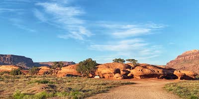
Wind and red dirt define the camping experience at Hamburger Rock, where 10 sites cluster around a distinctive sandstone formation on BLM land. The campground sits at 4,888 feet elevation, roughly seven miles from Canyonlands National Park's Needles District entrance.
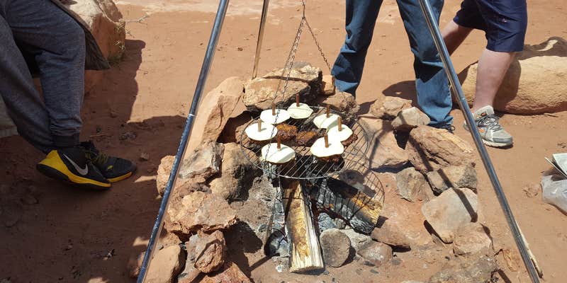
Most sites tuck against rock outcroppings that provide natural windbreaks, though campers consistently report gusty conditions that kick up fine sand. Kelly H. arrived during a snowstorm and noted "Red mud! Super fun. We were sweeping out red dirt for several days!" Each site includes a picnic table and fire ring, with two vault toilets serving the campground. The facilities lack running water, so campers must bring their own supply or obtain it from the Needles visitor center.
Site sizes vary considerably, with most accommodating tents and smaller RVs. A few larger pull-through spots can handle bigger rigs, though the uneven terrain limits options for large trailers. Free dispersed camping areas line the main gravel road both before and after the established campground for those seeking more space or level ground.
The $15 nightly fee operates on a first-come basis with no reservations accepted. A 14-day limit applies within any 30-day period. Cell service remains nonexistent for major carriers, though satellite internet works well. The campground stays open year-round when weather permits, with spring and fall offering the most comfortable temperatures for hiking in nearby Indian Creek Falls Group Site or exploring Canyonlands.
Pack extra stakes for wind protection and bring a camp broom for the inevitable red dust cleanup.
Description
Overview
Hamburger Rock Campground is a good option for visitors wishing to recreate in the Indian Creek area of Bears Ears National Monument or be close to the Needles District of Canyonlands National Park. The campground is located north off the Needles Highway (accessed from Utah State Route 211), approximately 3 miles southeast of Canyonlands National Park and 17 miles northwest of Newspaper Rock. The campground provides 10 campsites that each feature a tent/trailer space, a picnic table, a fire ring, and vault toilets. Each campsite can hold 10 people and 2 vehicles. There is no drinking water at the campground. Reservations are not available for camping at this location. Campsites are available on a first come, first served basis upon arrival at the self-register kiosk at the site. The Indian Creek area is generally primitive and undeveloped, with few services.
Recreation
The Indian Creek area of Bears Ears National Monument has gained international recognition for its extraordinary natural beauty and recreational opportunities. The Indian Creek canyon opens to a broad valley rimmed by Wingate Sandstone cliffs known for world-class rock climbing. Prominent geologic features include Lavender Mesa, Bridger Jack Mesa, and North and South Six Shooter Peaks. This spectacular setting and rich archeological resources provide visitors with recreational opportunities such as rock climbing, camping, cultural resource viewing, scenic photography, and off-highway vehicle (OHV) touring on designated routes.
Natural Features
The campsites are situated at the base of the Hamburger Rock geologic feature, a red sandstone monolith. A few of the sites are shaded by small juniper trees, but most are shaded only by the rock itself.
Nearby Attractions
Newspaper Rock Needles District of Canyonlands National Park
Contact Info
For facility specific information, please call (435) 587-1500.
Charges & Cancellations
No refunds are available.
Fee Info
Hamburger Rock Campground is first come, first served and payment must be made upon arrival at the self-register kiosk at the campground using cash, check, or the Scan & Pay feature on the Recreation.gov mobile app. You must have the Recreation.gov app installed on your mobile device prior to arrival to use the Scan & Pay payment method.
RV Road Trip Guides


Location
Public CampgroundHamburger Rock Campground is located in Utah
Directions
Turn west off U.S. Route 191 onto Utah State Route 211 and travel approximately 29.1 miles. Turn onto the Lockhart Basin Rd on the north side of the highway. The campground is located 1.2 miles down the maintained, gravel road on the east side of the road.
Address
BLM Monticello Field Office
365 N Main St
Monticello, UT 84535
Coordinates
38.191975 N
109.669503 W
Connectivity
 T-MobileNo CoverageVerified by 2 usersLast on 4/4/26
 VerizonPossible CoverageVerified by 33 usersLast on 4/4/26
- AT&TNo Coverage
Connectivity
- T-MobileNo CoverageVerified by 2 usersLast on 4/4/26
- VerizonPossible CoverageVerified by 33 usersLast on 4/4/26
- AT&TNo Coverage
Access
- Drive-InPark next to your site
- Walk-InPark in a lot, walk to your site.
Site Types
- Tent Sites
- RV Sites
- Standard (Tent/RV)
Features
For Campers
- Toilets
- Alcohol
- Pets
- Fires
For Vehicles
- Water Hookups
Drive Time
- 4 hrs 3 min from Grand Junction, CO
- 4 hrs 14 min from Farmington, NM
- 5 hrs 28 min from Provo, UT
- 5 hrs 59 min from Salt Lake City, UT


