Hikers can explore 8-10 miles of well-maintained trails that wind through maple forests, alongside clear creeks, and up to ridge overlooks at Lost Maples State Natural Area Campground. The established campground provides 24 electric sites with water and sewer hookups, each equipped with a covered picnic table, lantern pole, and fire ring with grill. Sites sit in an open layout with minimal tree coverage between them.
The drive-in sites accommodate RVs and large trucks, with gravel roads providing access throughout the campground. "Camp was clean and the area is awesome," reports Neil T., though he notes limited privacy between neighboring sites. Daily cleaning maintains the restroom facilities, which include showers, sinks, and water fountains. A small free library offers book exchanges for campers.
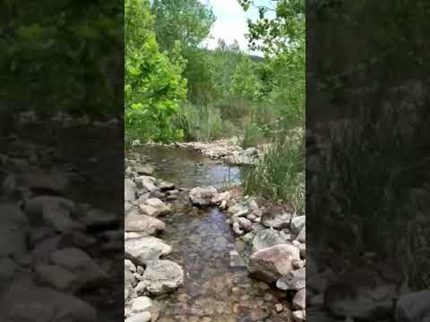
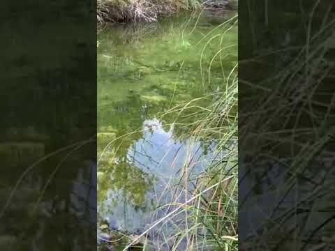
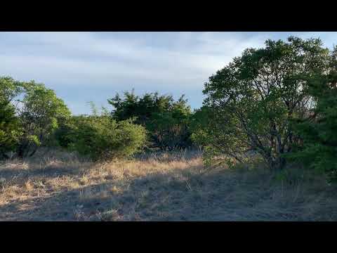
Trail options include the East Trail Loop, which climbs to ridge views, and the West Trail Loop, leading through forest into canyon areas. Creek crossings provide cooling spots during hot weather, with one wider swimming area accessible via hiking trails. "A really great climb in elevation for not having mountains," observes one reviewer about the terrain. Composting toilets mark several trail locations, clearly indicated on park maps available at the ranger station.
Fall foliage draws heavy crowds during the first three weeks of November, requiring reservations up to six months in advance. Summer temperatures can reach over 100 degrees, making shaded trail sections more comfortable for hiking. The park sits in a cellular dead zone with no phone service. Vanderpool, four miles away, has a general store with basic supplies and free wifi. Book campsites well ahead for autumn visits when maple colors peak.
Description
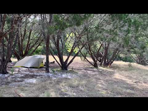
Campsites with 30 amp electricity and water hookup: 30 sites, 8 people per site allowed. Includes picnic table with shade shelter, fire ring, back-in RV parking, restrooms with showers nearby. Primitive Campsites (Hike-in): 50 sites. 6 people per site. Backpacking equipment is required. Fires are prohibited; you can use containerized fuel stoves for cooking. Carry out all trash and dispose of it responsibly. A maximum of six people can camp at each site; each primitive area has numerous sites. Off-trail hiking and rock climbing are not allowed. Pets are allowed on leash; pick up and dispose of pet waste properly. Please practice Leave No Trace principles, as the park has sensitive natural and cultural resources. Area C is closed to camping.
Fee Info
Campsites with Electricity: $20 nightly, $120 Weekly Non-peak. Plus daily entrance fee.
Primitive hike in sites: $10 nightly, plus daily entrance fee.
RV Road Trip Guides


Location
Public CampgroundLost Maples State Natural Area Campground is located in Texas
Directions
**Hwy 337 from Medina to Vanderpool will be closed by TxDot to replace the Mill Creek Bridge beginning November 9, 2020 and will reopen April 2021. Traffic will be rerouted to CR470 just west of Bandera, thru Tarpley and intersect with Hwy 187 N at Utopia. Travel 14 miles on Hwy 187 north to the park entrance. From San Antonio: Take Hwy 16 North to Medina. Take a left on FM 337 to Vanderpool. Take a right on HWY 187. Continue 5 miles to the Natural Area entrance. OR Take HWY 90 West to Sabinal. Take a right on HWY 187 and travel through Utopia to Vanderpool. Continue 5 miles to the Natural Area entrance. From Austin: Take I-35 South to New Braunfels. Take a right on HWY 46. Take a right on HWY 16. Travel through Bandera to Medina. Take a left on FM 337. Take a right on FM 187. Continue 5 miles to the Natural Area entrance. OR Take Hwy 290 West to US 281 North. Turn right and continue to follow US 281 North/Hwy 290 West. to Johnson City. Take a left and continue on HWY290 West. Take a left at Friendship Lane in Fredericksburg. Take a left onto US-87 South. Take a right on Ranch to Market 473 in Comfort. Take a right onto TX-27 West. Take a left at FM 480 North in Centerpoint. Take a right onto TX 173 South. Take a right onto FM 2828. Take a right onto TX-16 North. Take a left onto FM 337 in Medina. Take a right onto FM 187. Continue 5 miles to the Natural Area's entrance.**
Address
37221 FM 187
Vanderpool, TX 78885
Coordinates
29.80698088 N
99.5706324 W
Connectivity
 T-MobileNo Coverage
- VerizonNo Coverage
- AT&TNo Coverage
Connectivity
- T-MobileNo Coverage
- VerizonNo Coverage
- AT&TNo Coverage
Access
- Drive-InPark next to your site
- Walk-InPark in a lot, walk to your site.
- Hike-InBackcountry sites.
Site Types
- Tent Sites
- RV Sites
- Standard (Tent/RV)
- Group
- Tent Cabin
- Equestrian
Features
For Campers
- Picnic Table
- Reservable
- Showers
- Electric Hookups
- Alcohol
- Pets
- Fires
For Vehicles
- Sanitary Dump
- Sewer Hookups
- Water Hookups
- 30 Amp Hookups
- 50 Amp Hookups
Drive Time
- 1 hr 26 min from San Antonio, TX
- 1 hr 59 min from Eagle Pass, TX
- 2 hrs 15 min from San Angelo, TX
- 2 hrs 32 min from Austin, TX