Birch Creek Unit — Lake Somerville State Park, near Somerville, Texas, is a fantastic spot for campers looking to enjoy the great outdoors year-round. With a mix of tent sites, RV spots, and even yurts, there's something for everyone, whether you're a seasoned camper or just starting out.
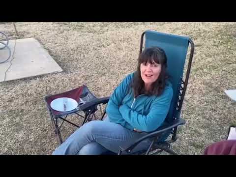
The campground is known for its clean facilities, including restrooms and showers, which visitors appreciate after a day of hiking or fishing. Many campers have highlighted the well-maintained sites and the friendly staff, making it a welcoming place to unwind. One visitor noted, “Great spot, all the amenities, friendly staff, clean restrooms, well-maintained campsites and nature.”
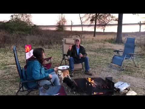
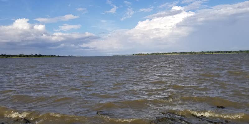
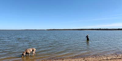
Outdoor activities abound here, with over 14 miles of equestrian trails and excellent birdwatching opportunities. The nearby lake offers a great kayaking area, and while the fishing pier is currently out of commission, there are still plenty of chances to cast a line. Campers have enjoyed the peaceful atmosphere, with one stating, “This place doesn’t disappoint. There are nice hiking trails. The lake views are beautiful.”
With ample green space between sites and plenty of trees for shade, Birch Creek Unit provides a comfortable camping experience. Whether you're hiking the trails or just relaxing by the water, this campground is a solid choice for your next outdoor adventure.
Description
This recreation area is part of Somerville Lake
RV Road Trip Guides


Location
Public CampgroundLake Somerville State Park Birch Creek Unit Campground is located in Texas
Directions
From Houston, take Highway 290 West to Brenham. Take SH 36 North through Somerville to Lyons. Turn left on Highway 60. Travel approximately eight miles. Turn left on Park Road 57. Park is four miles down Park Road 57. From Austin (north), take Highway 290 East to Highway 21. Left on 21 approximately 30 miles. Right on FM 60, 11 miles to Park Rd. 57. (Please note – Bridge located on FM 60, just before Deanville, has a max clearance of 12’ 10”). 4 miles on Park Road 57 to Park entrance. From Austin (south), take Highway 71 East to Bastrop. Highway 21 East approximately 45 miles. Right on FM 60, 11 miles to Park Road. 57 (Please note – Bridge located on FM 60, just before Deanville, has a max clearance of 12’ 10”). 4 miles on Park Road 57 to park entrance.
Address
14222 PARK ROAD 57
Somerville, TX 77879
Coordinates
30.30897296 N
96.6214352 W
Connectivity
 T-MobileLTESome CoverageVerified by 9 usersLast on 4/2/26
- VerizonLTESome CoverageVerified by 4 usersLast on 3/10/26
 AT&T5GExcellent CoverageVerified by 1 user
Connectivity
- T-MobileLTESome CoverageVerified by 9 usersLast on 4/2/26
- VerizonLTESome CoverageVerified by 4 usersLast on 3/10/26
- AT&T5GExcellent CoverageVerified by 1 user
Access
- Drive-InPark next to your site
- Hike-InBackcountry sites.
- Boat-InSites accessible by watercraft.
Site Types
- Tent Sites
- RV Sites
- Standard (Tent/RV)
- Group
- Yurts
- Equestrian
Features
For Campers
- Picnic Table
- Reservable
- Showers
- Electric Hookups
- Pets
- Fires
For Vehicles
- Sanitary Dump
- Sewer Hookups
- Water Hookups
- 30 Amp Hookups
- 50 Amp Hookups
Drive Time
- 56 min from College Station, TX
- 1 hr 31 min from Austin, TX
- 1 hr 35 min from Houston, TX
- 1 hr 48 min from Killeen, TX