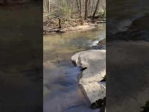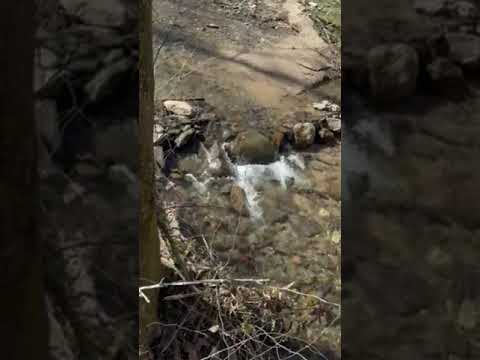
The sound of flowing water accompanies campers at this primitive Forest Service campground, where sites spread along Tumbling Creek without formal amenities or facilities. Located on gravel Forest Service roads in Cherokee National Forest, the campground requires either a longer approach through multiple forest roads or a shorter two-mile stretch on Forest Service Road 221 when accessed via paved Grassy Creek Road off Highway 68.
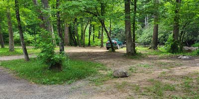
Campers pull in and select their own spots next to the river, creating a dispersed camping experience without designated sites or hookups. The creek provides the primary draw, offering fishing opportunities and the constant background of moving water. Traci W. notes visitors can "pull in, find a spot next to the river and enjoy" the lack of traffic noise and light pollution. The open lake accommodates small fishing boats, while the surrounding forest roads occasionally see trucks pulling boats during daylight hours.
Cell service reaches the area despite the remote location, and the primitive nature means no restrooms, water spigots, or trash collection. Campers seeking more developed options can explore campgrounds around Copperhill or check nearby Thunder Rock Campground for additional amenities. The gravel road access requires patience but rewards visitors with creek-side camping at no cost year-round.
Description
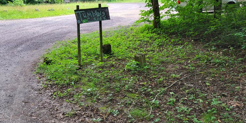
Located near Ocoee #3 Lake, this peaceful, remote campground offers 8 campsites along the banks of Tumbling Creek. Tumbling Creek Campground is convient to the Ocoee Whitewater Centers’ Tanasi trail complex which offers many miles and levels of difficulty for mountain bikers and hikers alike. If solitude is what you prefer, Big Frog Wilderness trails are also located nearby. Climbing to an altitude above 4,000 feet, some of these trails are rugged but reward the hiker with panoramic views of the mountains and the chance to see wildlife.
RV Road Trip Guides


Location
Public CampgroundTumbling Creek Campground is located in Tennessee
Directions
From the Ocoee Ranger Station turn left onto Highway 64 and travel about 10.9 miles to Ocoee Power House Number 3. Turn right and cross the bridge, following Forest Service Road 45 about 2.9 miles to Forest Service road 221. Turn left on 221 and the campground is 6.9 miles on the left.
Coordinates
35.01741091 N
84.46730681 W
Connectivity
 T-MobileNo Coverage
 VerizonLTESome CoverageVerified by 2 usersLast on 4/4/26
- AT&TLTESome Coverage
Connectivity
- T-MobileNo Coverage
- VerizonLTESome CoverageVerified by 2 usersLast on 4/4/26
- AT&TLTESome Coverage
Access
- Drive-InPark next to your site
Site Types
- Tent Sites
- RV Sites
- Standard (Tent/RV)
Features
For Campers
- Phone Service
- Alcohol
- Pets
- Fires
Drive Time
- 41 min from Cleveland, TN
- 1 hr 4 min from Chattanooga, TN
- 1 hr 38 min from Gainesville, GA
- 1 hr 51 min from Rome, GA