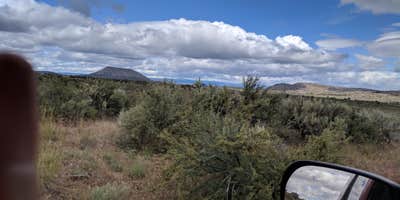
Nine campsites sit along a bumpy forest service road that leads to a small mountain lake in Mt. Hood National Forest. The drive requires careful navigation, as several reviewers mention rough conditions with potholes and narrow sections where tree branches brush vehicles. Cell service drops out well before reaching the campground, making offline maps essential.
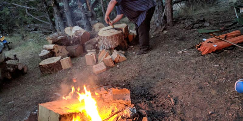
Half the sites provide direct lake access, while others sit back in heavily shaded areas under old-growth fir trees. Each site includes a picnic table and fire ring, with one vault toilet serving the entire campground. Pat S. notes "you can kayak or canoe on the lake" and mentions fishing opportunities. The lake also supports a hiking trail that connects to another lake to the north.
Mosquitoes present a significant challenge during summer months, with multiple reviewers emphasizing the need for repellent and recommending campfires for relief. The campground operates on a first-come, first-served basis and fills quickly during peak season, with some campers staying for extended periods. Sites accommodate RVs up to 16 feet, though the rough access road makes smaller vehicles more practical. For additional options in the region, campers can explore campgrounds around Mt. Hood National Forest.
Description
The campground is a single loop above the scenic high Cascade Hideaway Lake. The campsites are tucked under a heavy canopy of mixed conifers, including douglas fir and hemlock. Rhododendron and ample spacing provide excellent privacy. A very attractive, tranquil campground. Recreation activities include non-motorized boating, and fishing.
RV Road Trip Guides


Location
Public CampgroundHideaway Lake Campground - Mt. Hood National Forest is located in Oregon
Directions
In Estacada, OR at the intersection of State Rts. 211 and 224, take Rt. 224 east and go 24.7 miles to Ripplebrook Guard Station. Turn left immediately after Guard Station onto Forest Rt. 4631 and go 2.9 miles to a "Y" intersection. Bear right onto Forest Rt. 4630 and go 4.1 miles to an intersection and campground sign. Turn left onto Forest Rt. 57 (paved) and go 1 mile to a "Y" intersection. Bear left onto Forest Rt. 58 and go 3 miles to another "Y" intersection and campground sign. Bear left onto Forest Rt. 5830 (gravel) and go 4.1 miles to another "Y" intersection. Bear left, staying on Rt. 5830, and go 1.2 miles to an intersection and campground sign. Turn left at sign into campground.
Coordinates
45.1234319 N
121.967281 W
Connectivity
 T-MobileNo Coverage
- VerizonNo Coverage
- AT&TNo Coverage
Connectivity
- T-MobileNo Coverage
- VerizonNo Coverage
- AT&TNo Coverage
Access
- Drive-InPark next to your site
- Walk-InPark in a lot, walk to your site.
- Hike-InBackcountry sites.
- Boat-InSites accessible by watercraft.
Site Types
- Tent Sites
- RV Sites
- Standard (Tent/RV)
- Group
- Tent Cabin
Features
For Campers
- ADA Access
- Picnic Table
- Toilets
- Alcohol
- Pets
- Fires
Drive Time
- 1 hr 48 min from Portland, OR
- 2 hrs 14 min from Salem, OR
- 2 hrs 32 min from Albany, OR
- 2 hrs 49 min from Corvallis, OR


