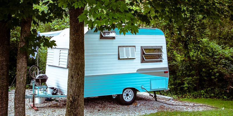
Hikers and bikers can access miles of maintained trails from Potato Creek State Park Campground, which spreads across nearly 300 sites in five loops near a 327-acre lake. The campground operates year-round and accommodates RVs up to 60 feet with full hookups, though campers should prepare extension cords up to 75 feet for some sites. Sites vary significantly in size and slope, with the back sites numbered 230-287 offering larger lots and more distance from the central playground area.
The campground fills quickly on weekends, transforming from quiet midweek stays to bustling family activity. Meg S. notes that "you literally can see and hear everything your neighbor is doing," reflecting the close spacing between most sites. Loop E tends to attract more RVs, while Loop D provides better spacing between sites. Each loop includes a comfort station with bathrooms and showers, though facilities show typical state park wear with occasional maintenance issues.
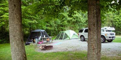
The lake features a sandy beach open Memorial Day through Labor Day, with a roped swimming area and boat rentals available. Fishing access extends around the shoreline beyond the crowded main dock. Multiple playgrounds serve families camping in the front loops, while paved bike paths connect to natural surface hiking trails throughout the park. The on-site general store stocks basics and firewood until 8 PM, even on Sundays.
Wetlands throughout the park attract abundant birdlife but also generate significant mosquito populations, particularly after periods of heavy rain. Cell service proves spotty, especially with Verizon. The three-mile drive from the park entrance to the campground office adds time to supply runs. For additional camping options in the region, see campgrounds near North Liberty. Reserve well ahead for summer weekends, as this popular family destination reaches capacity regularly.
Description
Potato Creek is located in north-central Indiana about 12 miles southwest of the city of South Bend. The park features a wide array of activities and facilities for year-round enjoyment. Making reservations is advisable to enjoy some of the facilities at this very popular park.
A variety of natural habitats await, including the 327-acre Worster Lake, old fields, mature woodlands, restored prairies and diverse wetlands. Each offers unique opportunities for plant and wildlife observation.
In the past, Native peoples used the area for hunting and fishing. The area's first people of European descent settled here in the 1830's
17 MILES SOUTHWEST OF THE METRO SOUTH BEND AREA
MINIMUM AGE TO RENT A CABIN IS 21 YEARS, THE PERSON REGISTERING FOR THE CABIN MUST BE STAYING. ITEMS NOT PROVIDED: TELEVISIONS, TELEPHONES OR AIR CONDITIONING, NO COFFEE MAKERS, DISHES, SILVERWARE OR UTENSILS, NO PILLOWS, BLANKETS OR LINENS, TOWELS OR FIREWOOD, NO CLEANING SUPPLIES. NO PETS ALLOWED IN CABINS OR CABIN AREA
Warning 2 Alerts are In Effect
There are 2 alerts for this campground. Camp safely!
Warning 2 Alerts are In Effect
There are 2 alerts for this campground. Camp safely!
From Mar. 30 to April 16, the main park road leading to the northside of Worster Lake will be temporarily closed due to roadwork and culvert repairs. Traffic heading to the family cabins, family campground, nature center, or other facilities located past the roadwork will need to check-in at the main gate or park office first, and then be redirected to the north access gate off New Rd. and Primrose Rd. We apologize for the temporary inconvenience.
Found in lakes year-round. Don't drink the water. Shower after you swim. More information.
RV Road Trip Guides


Location
Public CampgroundPotato Creek State Park Campground is located in Indiana
Directions
FROM THE NORTH: U.S. 31 SOUTH TO SR 4, WEST TO PARK ENTRANCE. FROM THE SOUTH: U.S. 31 NORTH TO SR 4, WEST TO PARK ENTRANCE. FROM THE EAST: USE EITHER U.S. 6 OR U.S. 30 WEST TO U.S. 31. NORTH TO SR 4 WEST TO PARK ENTRANCE. FROM THE WEST: I-80/90 EAST TO EXIT 72. TAKE 31/20 BYPASS SOUTH. SOUTH ON U.S. 31 TO SR 4. WEST TO PARK ENTRANCE.
Address
25601 State Rd #4
North Liberty, IN 46554
Coordinates
41.55689901 N
86.36918236 W
Connectivity
 T-MobilePossible CoverageVerified by 29 usersLast on 4/3/26
 VerizonLTEGood CoverageVerified by 13 usersLast on 4/3/26
 AT&T5GExcellent CoverageVerified by 4 usersLast on 4/3/26
Connectivity
- T-MobilePossible CoverageVerified by 29 usersLast on 4/3/26
- VerizonLTEGood CoverageVerified by 13 usersLast on 4/3/26
- AT&T5GExcellent CoverageVerified by 4 usersLast on 4/3/26
Access
- Drive-InPark next to your site
- Walk-InPark in a lot, walk to your site.
- Hike-InBackcountry sites.
- Boat-InSites accessible by watercraft.
Site Types
- Tent Sites
- RV Sites
- Standard (Tent/RV)
- Group
- Cabins
- Tent Cabin
- Equestrian
Features
For Campers
- Market
- Picnic Table
- Reservable
- Showers
- Drinking Water
- Electric Hookups
- Toilets
- Alcohol
- Pets
- Fires
For Vehicles
- Sanitary Dump
- Sewer Hookups
- Water Hookups
- Pull-Through Sites
- 30 Amp Hookups
- 50 Amp Hookups
- Big Rig Friendly
Drive Time
- 16 min from South Bend, IN
- 30 min from Niles, MI
- 34 min from Elkhart, IN
- 40 min from Michigan City, IN


