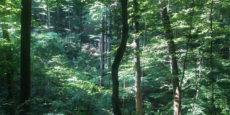
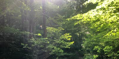
Rough gravel roads lead into this wilderness area within Hoosier National Forest, where dispersed camping and established sites provide different levels of backcountry access. The terrain features dense forest cover with multiple creek systems winding through the landscape, creating natural corridors for hiking and exploration.
Official campsites include rock fire rings and basic amenities like toilets and drinking water, while dispersed camping allows backpackers to establish primitive camps throughout the wilderness boundaries. Multiple access points accommodate different camping styles - some sites remain drive-accessible while others require hiking in with gear. Hardin Ridge sits nearby for campers preferring developed facilities.
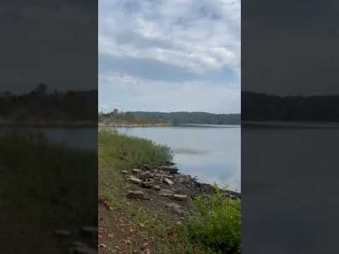
Trail networks follow creek beds and connect to lake access points, though several reviewers note that reaching the water requires more effort than expected. Storm damage has rerouted some trails in recent years, occasionally creating new camping opportunities off established paths. The area attracts college-age visitors due to its proximity to town, and previous campers sometimes leave trash behind at popular sites.
Sarah R. found "an abundance of spaces" for backcountry camping along creek corridors. Mosquitoes and ticks become problematic after rain periods, and parking remains limited at trailheads, particularly on weekends. The wilderness works best for campers comfortable with primitive conditions and willing to pack out others' waste when necessary.
Description
The Charles C. Deam Wilderness offers 36 miles of trails for hiking, backpacking, and horse riding through scenic hardwood forest and varied terrain with views of nearby Monroe Lake. The area was designated a wilderness in 1982 and encompasses nearly 12,953 acres of the Hoosier National Forest. Wilderness designation places this area in a special legal status (subject to the 1964 Wilderness Act). It is managed to preserve a natural condition and provide opportunities for solitude. Since its designation as a wilderness, visitor use in the area increased to a point that significant damage was occurring. Special restrictions are in place to protect the wilderness character. Visitors to this special place are asked to follow these restrictions to lessen your impact and share responsibility in preserving this unique natural resource.
RV Road Trip Guides

Location
Public CampgroundCharles C. Deam Wilderness is located in Indiana
Directions
From east State Route 46 in Bloomington, take State Route 446 south to Tower Ridge Road. You will see a sign for the Charles C. Deam Wilderness and the Maumee Boy Scout Camp. This gravel road is after the lake and on the left as you are heading south. The Wilderness boundary begins just a few hundred feet down this road and continues for several miles. Please get a map before visiting this area, as the boundaries are not clearly marked.
Coordinates
39.02070084 N
86.38380036 W
Connectivity
 T-MobileNo CoverageVerified by 5 usersLast on 4/2/26
 VerizonLTESome CoverageVerified by 4 usersLast on 4/2/26
 AT&T5GExcellent CoverageVerified by 2 usersLast on 4/2/26
Connectivity
- T-MobileNo CoverageVerified by 5 usersLast on 4/2/26
- VerizonLTESome CoverageVerified by 4 usersLast on 4/2/26
- AT&T5GExcellent CoverageVerified by 2 usersLast on 4/2/26
Access
- Drive-InPark next to your site
- Walk-InPark in a lot, walk to your site.
- Hike-InBackcountry sites.
- Boat-InSites accessible by watercraft.
Site Types
- Tent Sites
- Standard (Tent/RV)
- Dispersed
- Group
- Equestrian
Features
For Campers
- Trash
- Phone Service
- Drinking Water
- Electric Hookups
- Toilets
- Alcohol
- Pets
- Fires
Drive Time
- 23 min from Bloomington, IN
- 56 min from Columbus, IN
- 1 hr 12 min from Indianapolis, IN
- 1 hr 27 min from Terre Haute, IN