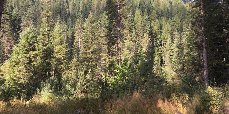
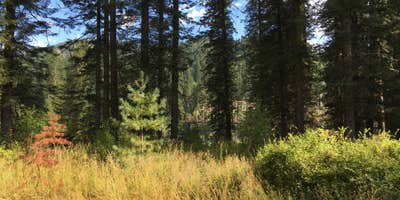
Fishing enthusiasts will find direct access to Weitas Creek at this US Forest Service campground in Clearwater National Forest. The free campground offers basic amenities including vault toilets, picnic tables, and fire rings, though reviewers note the facilities could use maintenance attention.
Sites are positioned near the creek with varying levels of tree cover. Two sites flanking the bridge receive the most positive feedback from campers, while others may experience dust from passing traffic. The campground can see increased activity before evening hours but generally remains less crowded than developed alternatives. For campers wanting more amenities, Station Creek Camp sits 3.6 miles west.
Description
Weitas Campground is a very popular, no fee campground that’s located about 35 miles northeast of Pierce, just off Forest Service road [FSR] 250. Much of the campground’s appeal comes from its location along the shady banks of Weitas Creek, just south of the North Fork of the Clearwater River (you cross a bridge to reach the campground.) There are only six campsites, so Weitas Campground tends to fill quickly during the height of the summer recreation season. Trail #20 runs south, and then east, out of the campground, providing miles of first-class bank fishing opportunities. The trail eventually junctions with FSR 500, the Lolo Motorway.
RV Road Trip Guides


Location
Public CampgroundWeitas Creek Campground is located in Idaho
Directions
Directions – From U.S. Highway 12, via Pierce: Take U.S. Highway 12 to Greer, ID, and turn east on State Highway 11. Follow Highway 11 for approximately 28 miles, toward Pierce, ID. You will pass through the small town of Weippe. One mile south of Pierce, turn right on Forest Service road 250 (French Mountain Road). Continue on FSR 250 for about 30 miles, until you reach the intersection of FSR 247 near Bungalow. Turn right and stay on FSR 250 for about four miles. Turn right onto the Weitas Creek Bridge. The campground is on the south side of the North Fork of t he Clearwater River. Directions – From U.S. Highway 12, via Orofino: Take U.S. Highway 12 to Orofino, ID. Cross the bridge that spans the main Clearwater River; Michigan Avenue takes off from the east end of the bridge. Continue driving east until the Michigan Avenue becomes Grangemont Road. Stay on Grangemont Road and make your way to the junction with State Highway 11, a distance of about 26 miles. Turn right on Highway 11 and drive south for approximately six miles; you will pass through the small town of Pierce. One mile south of Pierce, turn left on FSR 250 (French Mountain Road). Proceed on FSR 250 for about 30 miles, until you reach the intersection of FSR 247 near Bungalow. Turn right and stay on FSR 250 for about four miles. Turn right onto the Weitas Creek Bridge. The campground is on the south side of the North Fork of the Clearwater River.
Coordinates
46.63861201 N
115.43332867 W
Connectivity
 T-MobileNo Coverage
- VerizonNo Coverage
- AT&TNo Coverage
Connectivity
- T-MobileNo Coverage
- VerizonNo Coverage
- AT&TNo Coverage
Access
- Drive-InPark next to your site
Site Types
- Tent Sites
- RV Sites
- Equestrian
Features
For Campers
- Picnic Table
- Toilets
- Alcohol
- Pets
- Fires
Drive Time
- 3 hrs 15 min from Lewiston, ID
- 4 hrs 31 min from Missoula, MT
- 4 hrs 56 min from Spokane, WA
- 5 hrs 4 min from Coeur d'Alene, ID


