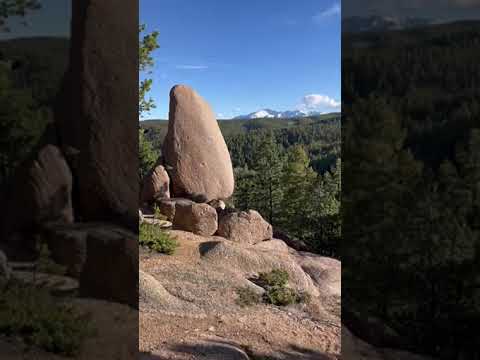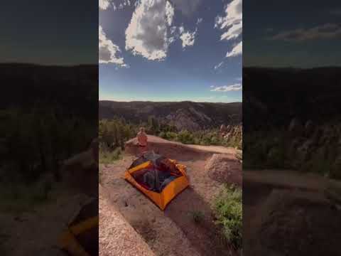
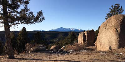
Mount Herman Road winds through Pike National Forest, climbing from Monument into dispersed camping sites scattered along a rocky mountain road. The route requires four-wheel drive for the upper elevations, where campers find the largest sites with expansive views across the Colorado Rockies.
Multiple camping spots dot the mountainside at various elevations, from roadside pulloffs lower on the mountain to spacious clearings near the summit. Ben H. notes "the larger camping sites are located closer to the top. With great views." The road itself becomes part of the camping experience, with narrow switchbacks and steep grades that test driving skills while delivering access to more secluded spots. Cell service reaches partway up the mountain before fading at higher elevations.
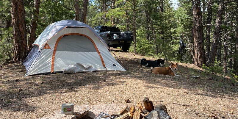
Established fire rings mark previous camping spots throughout the area, though campers report mixed conditions regarding cleanliness and leftover materials. Glass and trash appear at some sites, while others remain relatively clean. Firewood collection requires effort, as Ciara G. discovered: "The branches you can find around wouldn't really be enough for a long lasting fire." Wind exposure increases with elevation, particularly at the mountain's upper reaches.
The area connects to hiking, biking, and equestrian trails, with the Mount Herman trailhead serving as a reference point along the access road. Weekend traffic picks up considerably, making the narrow road busier and reducing solitude. Weather conditions affect road accessibility, with snow accumulation creating additional challenges during colder months.
For those exploring the broader region, campgrounds around Pike National Forest provide additional forest camping options. The drive from Monument takes roughly 50 minutes to reach the upper camping areas, depending on road conditions and vehicle capability.
Description
Part of Pike and San Isabel National Forests Cimarron and Comanche National Grasslands. Mount Herman Trail begins at a small parking area on a switchback on Mount Herman Road. This trail provides a 2-mile one-way hike to the summit of Mt. Herman.
RV Road Trip Guides


Location
Dispersed CampingMount Herman Road Dispersed Camping is located in Colorado
Directions
From Monument, travel west on 2nd Street. Just past the railroad tracks, 2nd St. dead ends at a T. Turn left (south) on Mitchell Rd. Travel approximately 1/2 mile to Mt. Herman Rd. Turn right (west) on Mt. Herman Rd and travel for approximately 7 miles beyond the paved portion of road. The trailhead is a wide turnout on the right side of Mt. Herman Rd.
Coordinates
39.07114015 N
104.93210397 W
Connectivity
 T-MobilePossible CoverageVerified by 42 usersLast on 4/3/26
 VerizonLTEGood CoverageVerified by 42 usersLast on 4/3/26
- AT&TPossible CoverageVerified by 20 usersLast on 4/3/26
Connectivity
- T-MobilePossible CoverageVerified by 42 usersLast on 4/3/26
- VerizonLTEGood CoverageVerified by 42 usersLast on 4/3/26
- AT&TPossible CoverageVerified by 20 usersLast on 4/3/26
Access
- Drive-InPark next to your site
- Walk-InPark in a lot, walk to your site.
Site Types
- Dispersed
Features
For Campers
- Firewood Available
- Phone Service
- Alcohol
- Pets
- Fires
DISPERSED CAMPING
Enjoy dispersed camping on government land and leave no trace. Pack in and pack out. No (or limited) services at this camping area. Permit may be required.
PERMIT might be REQUIRED
We curate permit requirements across the US for our PRO members. Try PRO to see if Mount Herman Road Dispersed Camping needs a permit.
Drive Time
- 41 min from Colorado Springs, CO
- 1 hr 8 min from Denver, CO
- 1 hr 12 min from Pueblo, CO
- 1 hr 31 min from Boulder, CO