Fishing and swimming opportunities draw campers to this US Forest Service group site within Eldorado National Forest. South Fork Group accommodates RVs up to 50 feet and requires reservations, with a $100 fee reflecting its group camping designation. The forested setting provides proximity to creek, river, and lake access for water-based activities.
No pets are permitted at this drive-in campground near Pollock Pines. Campers seeking additional options can explore camping near Eldorado National Forest, while South Fork Group Campground sits just 0.1 miles northwest for those wanting a different group camping experience.
Description
Overview
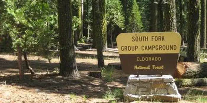
South Fork is the largest group campground in the Crystal Basin Recreation Area, nestled in the vast expanse of the Eldorado National Forest. The remote location affords visitors a true outdoor camping experience.
Recreation
With the South Fork of the Rubicon River located within walking distance, the group camp provides excellent fishing, swimming and other water sports and activities.
Facilities
While the campground can be used as a single group site that can accommodate up to 125 guests, it can also be reserved as multiple single-family sites. A group cooking area with food preparation tables and double grills is available, as well as campfire rings with grills at each site. Vault toilets are provided, however, drinking water is not available at the campground. Visitors can boil stream water or fill up at nearby boat ramps. A parking area is also available.
Natural Features
Situated at an elevation of 5,200 feet, the campground sits between the Union Valley Reservoir and Loon Lake. It is also just minutes away from Gerle Creek Reservoir, a serene mountain lake where motorized boating is prohibited in order to preserve a peaceful and quiet atmosphere for visitors.
Nearby Attractions
Swimming and non-motorized boating are available at Gerle Creek Reservoir, 5 miles north of the campground.
RV Road Trip Guides


Location
Public CampgroundSouth Fork Group - Eldorado Nf (CA) is located in California
Directions
Travel 21 miles east from Placerville on Highway 50 and turn left on the Ice House Road. Go 25 miles north and turn left on South Fork Road. The campground is a mile from the turn-off, on the right side of the road.
Address
7887 HIGHWAY 50
Pollock pines, CA 95726
Coordinates
38.94833 N
120.402133 W
Connectivity
 T-MobileNo Coverage
- VerizonNo Coverage
- AT&TNo Coverage
Connectivity
- T-MobileNo Coverage
- VerizonNo Coverage
- AT&TNo Coverage
Access
- Drive-InPark next to your site
Site Types
- Tent Sites
- RV Sites
- Standard (Tent/RV)
- Group
Features
For Campers
- Reservable
Drive Time
- 1 hr 32 min from Sacramento, CA
- 1 hr 54 min from Yuba City, CA
- 1 hr 58 min from Carson City, NV
- 2 hrs 25 min from Reno, NV
