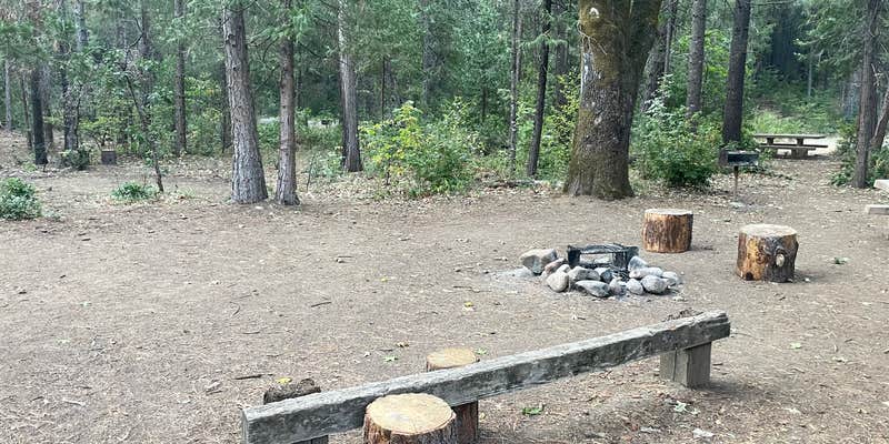
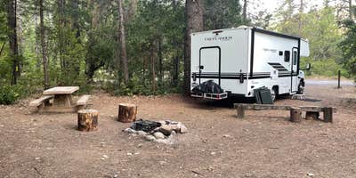
The sound of the Sacramento River flowing nearby sets the tone at this Forest Service campground, where 17 sites spread across open terrain with varying shade options. Campers can choose between full sun exposure or ample shade depending on their preference, with sites like #4 and #17 offering particularly good tree cover during hot weather.
Most sites accommodate RVs up to 24 feet without requiring leveling, though the access road can present challenges. Train traffic on the opposite side of the river creates regular noise throughout the night, including whistles and wheel sounds that carry across the water. "Sound of the water was nice to sleep to," notes hannah, though the railroad activity provides a contrasting soundtrack.
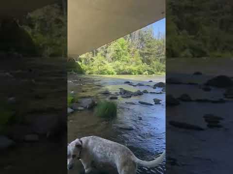
A paved interpretive trail loops through the campground with historical markers about the former conservation corps camp that once occupied this site. The path leads to river access points, though getting into the water requires some effort due to the bank conditions. Small gnats can be persistent around the eyes, prompting the campground host to wear protective netting. Clean restrooms with working lights and toilet paper serve the sites, with a newer facility at the far end of the campground.
The location works well as an overnight stop for travelers, staying typically uncrowded while providing easy access to I-5. For additional options in the region, campers can explore camping spots near Shasta National Forest.
Description
Description : This campground is located alongside the Sacramento River at an elevation of 1600 feet. There are 19 sites with tables and fire-rings. Suitable for tents and mid-sized RVs or trailers. Flush toilets; piped water. 14 day limit. $15 per night. No reservations. Usually opens by last Saturday in April and closes Nov. 15th. Features : Historic location of Civilian Conservation Corps camp in the 1930s. Interpretive signs depict the camp and suspension bridge spanning the river built by the CCC. World renown fishing on a classic trout stream. Train buffs enjoy watching Union Pacific freight trains as they make their way through the canyon. Also popular with whitewater boaters during the high water of spring runoff.
RV Road Trip Guides


Location
Public CampgroundSims Flat Campground is located in California
Directions
From Mt. Shasta city, take I-5 south approximately 20 miles to the Sims exit. Turn left under the freeway and drive another mile to the bridge that crosses the Sacramento River. The campground entrance is on the right, just past the bridge.
Coordinates
41.06200064 N
122.35900075 W
Connectivity
 T-MobileLTESome CoverageVerified by 5 usersLast on 4/2/26
- VerizonLTESome CoverageVerified by 5 usersLast on 4/2/26
 AT&TLTEGood CoverageVerified by 12 usersLast on 4/2/26
Connectivity
- T-MobileLTESome CoverageVerified by 5 usersLast on 4/2/26
- VerizonLTESome CoverageVerified by 5 usersLast on 4/2/26
- AT&TLTEGood CoverageVerified by 12 usersLast on 4/2/26
Access
- Drive-InPark next to your site
Site Types
- Tent Sites
- RV Sites
- Standard (Tent/RV)
- Group
Features
For Campers
- ADA Access
- Trash
- Picnic Table
- Phone Service
- Drinking Water
- Toilets
- Alcohol
- Pets
- Fires