Oakwilde Trail Campground is located near Flintridge, CA, surrounded by rugged terrain with a mix of hills and forested areas. Temperatures in the area typically range from 40°F in winter to 90°F in summer. Nearby attractions include the Angeles National Forest, offering hiking trails and scenic views, and the Jet Propulsion Laboratory, which provides educational tours.
Description
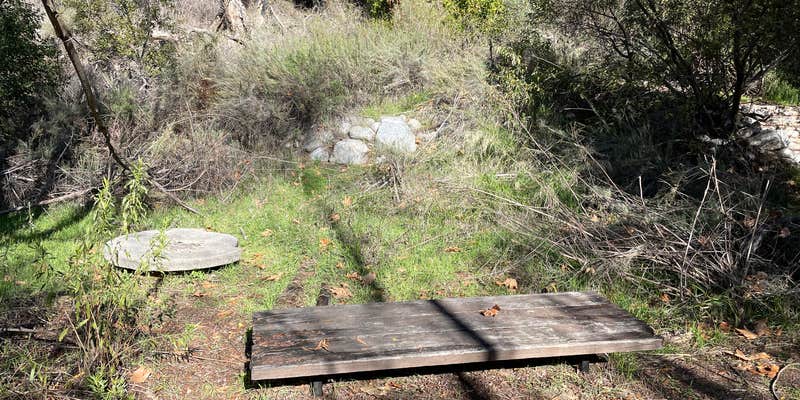
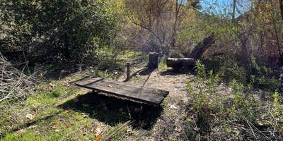
1800-foot elevation. 5 hike-in campsites. 2 hitching rails. Stream water (treat before using). However, water flow may be low or non-existent due to reduced rainfall. Campsites are first come - first served. Interagency Pass or Adventure Pass required for vehicles parked at Switzer Picnic Area. Caution: Be alert for high water in the rainy season. Call (818) 899-1900, ext. 221 for current conditions and additional information.
RV Road Trip Guides

Location
Public CampgroundOakwilde Trail Campground is located in California
Directions
Location: From Interstate 210 in La Canada, exit Angeles Crest Hwy. (Hwy.2) and drive 9.5 miles north to Switzer's Picnic Area and hike down the trail 3 miles. Or exit Windsor/Arroyo off ramp in La Canada and go north to the intersection of Ventura St. Hike in from gated fire road 5 miles to Oakwilde.
Coordinates
34.24561245 N
118.18359955 W
Connectivity
 T-Mobile5GGood CoverageVerified by 3 usersLast on 4/3/26
 VerizonNo CoverageVerified by 2 usersLast on 4/3/26
- AT&T5GGood Coverage
Connectivity
- T-Mobile5GGood CoverageVerified by 3 usersLast on 4/3/26
- VerizonNo CoverageVerified by 2 usersLast on 4/3/26
- AT&T5GGood Coverage
Access
- Hike-InBackcountry sites.
Site Types
- Tent Sites
Features
For Campers
- Firewood Available
Drive Time
- 31 min from Los Angeles, CA
- 1 hr 10 min from Oxnard, CA
- 1 hr 33 min from Bakersfield, CA
- 2 hrs 10 min from San Diego, CA