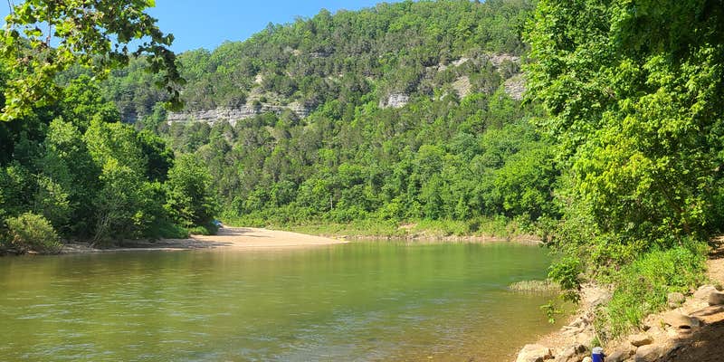
Where the Buffalo National River carves through the Arkansas Ozarks, South Maumee Camping Area provides direct river access alongside established campground amenities. This National Park Service facility sits in forested terrain along the water, though campers should prepare for challenging road conditions to reach the site.
The campground serves multiple user groups, from tent campers to RV travelers with full hookups including electric, water, and sewer connections. A gravel bar extends into the river, creating space for boat launches and riverside activities. "Very clean, people did a great job of picking up after themselves," notes Jason W., highlighting the maintained condition despite heavy use by outfitters and river visitors.
Access requires navigating what reviewers describe as a rough, lengthy road from the main highway. The primitive facilities include restrooms and shower buildings, though shelter options remain limited during severe weather. Campers can reserve sites in advance, and pets are welcome throughout the area. For those seeking pet-friendly camping near Buffalo National River, this location accommodates both paddlers and land-based campers.
River enthusiasts will find Spring Creek Campground — Buffalo National River three miles east for an alternative Buffalo River experience.
Description
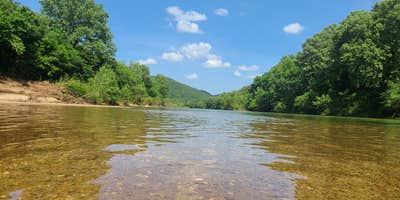
Located in northern Arkansas, the Buffalo River flows for 153 uninterrupted miles, from its origin in the Ozarks’ Boston Mountains eastward to its confluence with the White River. In 1972, the Buffalo was designated America’s first National River, and is currently managed jointly by the US Forest Service and the US National Park Service. Over the course of its journey, the Buffalo passes sandstone and limestone bluffs, mixed upland forests, and flows through three wilderness areas: Upper Buffalo, Ponca, and Lower Buffalo. Along the river are more than 12 campgrounds, as well as primitive camp areas, which provide a variety of options for taking advantage of the area’s numerous hiking trails, as well as rafting, paddling and fishing on the river. Accessible via a 7-mile gravel road from the small town of Morning Star, on Highway 27, South Maumee Campground offers five free, first-come, first-served campsites. Each site is equipped with picnic tables, fire rings and lantern posts. A vault toilet is available, but no trash service, so campers need to pack out all garbage; hookups are not available at this location. The campground is situated on a wide, sandy bend on the Buffalo River, so river access is easy for swimming and fishing, however there is no boat launch. A boat launch is available at the North Maumee Campground, on the other side of the river, and accessible via Highway 14. In addition to river recreation, there are 14 miles of hiking trails in the area for exploring an old mining townsite, an indigenous peoples’ bluff shelter, and scenic viewpoints.
RV Road Trip Guides


Location
Public CampgroundSouth Maumee Camping Area — Buffalo National River is located in Arkansas
Coordinates
36.0397035 N
92.6360154 W
Connectivity
 T-MobileNo Coverage
- VerizonNo Coverage
- AT&TNo Coverage
Connectivity
- T-MobileNo Coverage
- VerizonNo Coverage
- AT&TNo Coverage
Access
- Drive-InPark next to your site
- Walk-InPark in a lot, walk to your site.
- Boat-InSites accessible by watercraft.
Site Types
- Tent Sites
- RV Sites
- Group
Features
For Campers
- ADA Access
- Trash
- Picnic Table
- Phone Service
- Reservable
- Showers
- Drinking Water
- Electric Hookups
- Toilets
- Alcohol
- Pets
- Fires
For Vehicles
- Sanitary Dump
- Sewer Hookups
- Water Hookups
- Pull-Through Sites
Drive Time
- 2 hrs 10 min from Little Rock, AR
- 2 hrs 32 min from Springfield, MO
- 2 hrs 46 min from Fayetteville, AR
- 3 hrs 9 min from Fort Smith, AR


