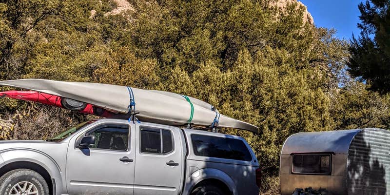
Accessible via Highway 80 from the south, this 10-site Forest Service campground sits in Cave Creek Canyon within the Chiricahua Mountains. Sites accommodate RVs up to 22 feet on paved back-in spots, though Kennon H. notes "water hydrant for bucket and jug fills" rather than hookups. The $20 per night fee operates on a first-come, first-served basis year-round.
Each site includes a picnic table, fire ring, and bear locker, with shelters covering tables at sites without tree cover. The vault toilet receives consistent praise from campers for cleanliness. Heavy tree canopy provides shade but can pose clearance issues for taller RVs. Wildlife sightings include deer families that bed down near campsites.
March and April bring peak crowds as birders arrive seeking resident species, making weekend availability scarce during these months. The South Fork Trail begins directly from the campground, offering a 4.1-mile route with creek crossings. Solar users appreciate the open areas between trees that provide adequate sun exposure.
Stewart Campground sits just over half a mile northeast for campers seeking alternatives. Those wanting additional options can explore campgrounds around Coronado National Forest throughout the surrounding mountain range.
Description
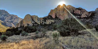
Campsites are clustered around a grassy meadow in this relatively open streamside camp. All sites are shaded, some more than others, and all are reasonably close to Cave Creek. Birdwatching is good right in camp (as it is in all Cave Creek camps) with elegant trogons and many other interesting species sighted regularly among the sycamores and oaks that border the creek. The open character of the area makes for exciting views of Cave Creek Canyon’s famous rock formations which tower over the area. Other recreation attractions in Cave Creek Canyon, such as birding areas along South Fork and a number of hiking trails, are just a short drive from this campground, which is along the Cave Creek Canyon/Portal to Paradise Loop scenic drive. Some attractions you may want to take advantage of while you’re camped at Sunny Flat are the scenic Vista Point Trail located a short distance downstream of the campground, and the Cave Creek Visitor Information Center a little farther downstream. The Center, is open year-round, offers interpretive information, books and pamphlets on the natural and cultural history of the area, and a few examples of local wildlife species. Note: Black bears in area.
RV Road Trip Guides


Location
Public CampgroundSunny Flat Campground is located in Arizona
Directions
From Douglas, take US 80 east approximately 50 miles to Rodeo, NM. Two miles past Rodeo, turn left (west) on Portal Road. From Portal drive west on Forest Road 42, approximately 3 miles to Sunny Flat Campground. All roads are paved and suitable for passenger vehicles.
Coordinates
31.88524011 N
109.17572018 W
Connectivity
 T-MobileNo Coverage
- VerizonNo Coverage
- AT&TNo Coverage
Connectivity
- T-MobileNo Coverage
- VerizonNo Coverage
- AT&TNo Coverage
Access
- Drive-InPark next to your site
- Walk-InPark in a lot, walk to your site.
- Hike-InBackcountry sites.
Site Types
- Tent Sites
- RV Sites
- Standard (Tent/RV)
Features
For Campers
- ADA Access
- Trash
- Picnic Table
- Drinking Water
- Toilets
- Alcohol
- Pets
- Fires
Drive Time
- 1 hr 58 min from Sierra Vista, AZ
- 2 hrs 18 min from Tucson, AZ
- 2 hrs 33 min from Las Cruces, NM
- 3 hrs 2 min from El Paso, TX


