Fishing enthusiasts and mountain campers will find Riggs Flat Campground positioned around a small stocked lake at 9,000 feet elevation in the Pinaleño Mountains. The campground sits 40 miles southwest of Safford via Highway 366, which transitions from paved road to maintained dirt for the final stretch up the mountain. This Forest Service facility operates seasonally from April through November with 20 sites accommodating RVs up to 22 feet.
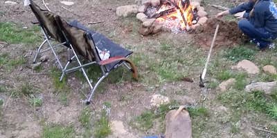
The lake provides easy fishing access for trout and bass, though visitors need valid Arizona fishing licenses with trout stamps. Kaileen F. notes "very easy access to this cute little Lake that is stocked with fish." Sites feature standard picnic tables and fire rings with vault toilets and drinking water available. The campground includes water hookups and a dump station for RVs.
Wildlife encounters are common, particularly with skunks that forage through campsites at night. The pine forest setting offers hiking trails and opportunities to spot deer, endangered red squirrels, and black bears as elevation zones transition from desert to mountain ecosystems. Cell service remains limited within the campground but can be found at the western edge of the mountain.
The rough mountain road with switchbacks challenges smaller vehicles and longer RVs. For additional camping options in the region, campers can explore camping near Pima. This location works best for anglers, hikers, and campers comfortable with mountain access roads.
Description
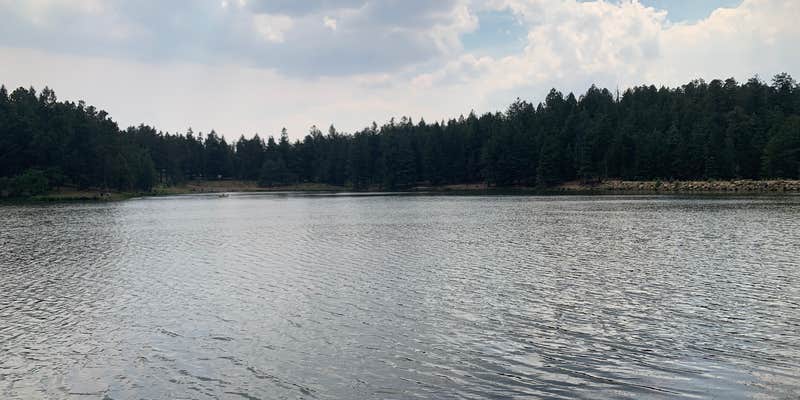
Mt. Graham camping and Riggs Flat Lake at Riggs Flat Campground. Experience Some come to fish in it, some to boat on it, and some just to enjoy the reflective beauty this small (11 acre) lake adds to such a scenic area. The dam was financed by the Arizona Game and Fish Department in 1957 to provide trout fishing for forest recreationists. Information about stocking Riggs Lake is available from Arizona Game and Fish Department.
RV Road Trip Guides


Location
Public CampgroundRiggs Flat Campground is located in Arizona
Directions
In Safford, AZ, at intersection of US Rt. 70 (5th St.) and US Rt. 191, take Rt. 191 south for 7.4 miles to State Rt. 366. Turn right onto Rt. 366 and go 33.7 miles to campground sign. Turn left at sign onto Forest Rt. 287 and go 0.9 miles to campground
Coordinates
32.70628004 N
109.96404036 W
Connectivity
 T-MobileNo Coverage
- VerizonNo Coverage
- AT&TNo Coverage
Connectivity
- T-MobileNo Coverage
- VerizonNo Coverage
- AT&TNo Coverage
Access
- Drive-InPark next to your site
- Walk-InPark in a lot, walk to your site.
- Hike-InBackcountry sites.
Site Types
- Tent Sites
- RV Sites
- Standard (Tent/RV)
- Group
Features
For Campers
- Trash
- Picnic Table
- Firewood Available
- Phone Service
- Drinking Water
- Toilets
- Alcohol
- Pets
- Fires
For Vehicles
- Sanitary Dump
- Water Hookups
Drive Time
- 2 hrs 50 min from Sierra Vista, AZ
- 2 hrs 52 min from Tucson, AZ
- 4 hrs 7 min from Las Cruces, NM
- 4 hrs 21 min from Phoenix, AZ